
WARDOGS map and terrain
WARDOGS map and terrain
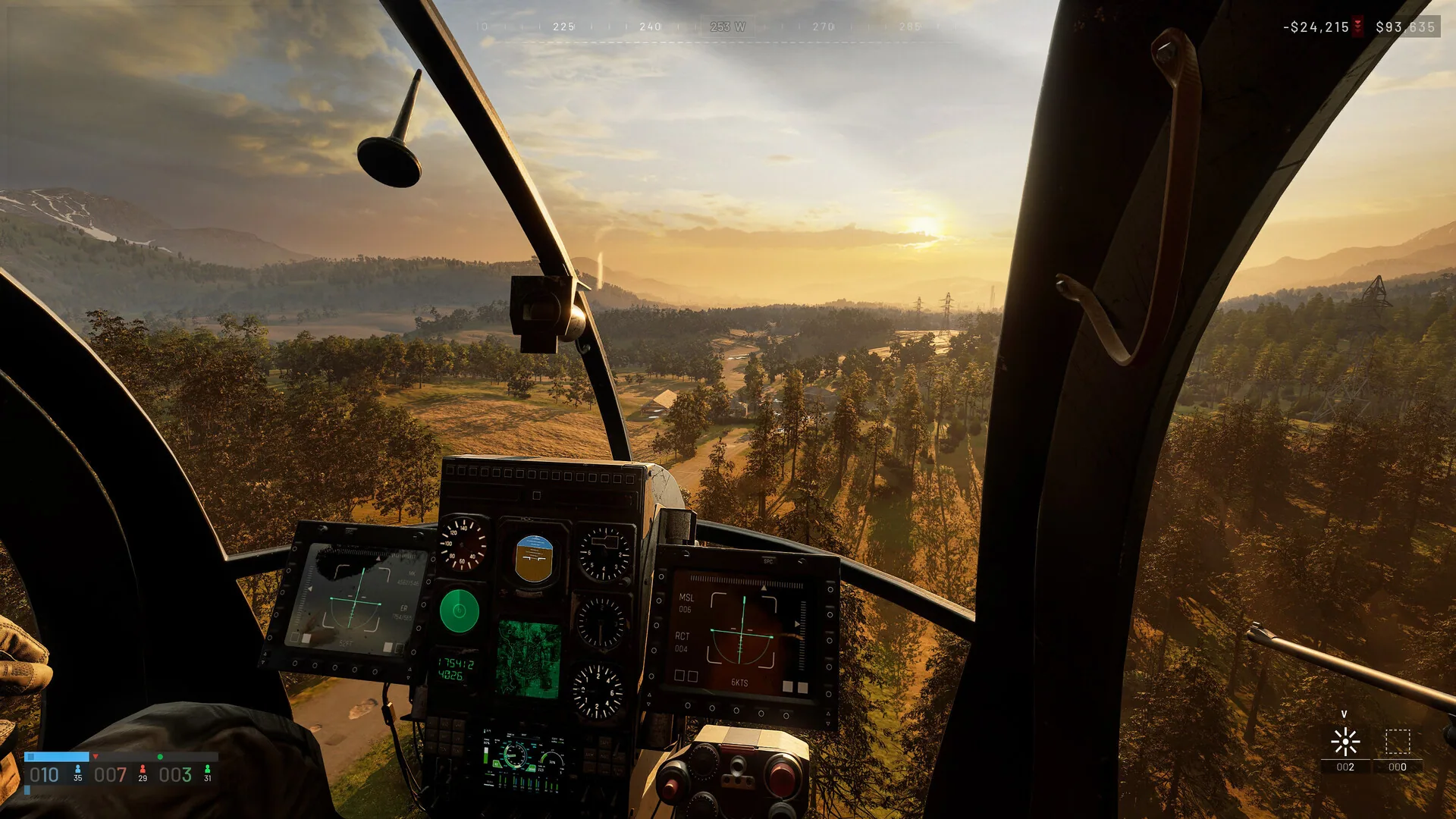
Terrain is the space between a Control Zone marker and the team action that makes it matter. The public record separates a randomized 2x2 km zone from a 256 km² wider battlefield and shows mountain, industrial and damaged-building contexts in the official media. Use those fields to think about approach, sightline, transport, construction and recovery without turning a selected screenshot into a complete map. A route review should always name arrival, sightline, cover and recovery, because those four fields turn visual context into a team decision.
STRUCTURED SCALE RECORD
Terrain fields that change a route
Two scales, two decisions
The 2x2 km figure describes the randomized Control Zone, the immediate area where teams contest majority control. The 256 km² figure describes the larger battlefield that surrounds and connects those contests. A player inside the zone asks where to hold or cross; a player outside it asks how to arrive with time, cover and a useful team task. Reading both scales prevents the map from becoming either a tiny arena or an abstract expanse.
The scale difference also explains why transport, construction and cash belong in a terrain record. A helicopter can change arrival timing, a FOB can make a return route possible, and a cash spend can keep the squad active after a long approach. The best route is not always the shortest line; it is the path that leaves the team able to contest when it arrives.
Use the live zone and team movement to make the immediate choice. Use the public scale as a planning frame, not as a claim about every location or match boundary.
Read the visual environments as route problems
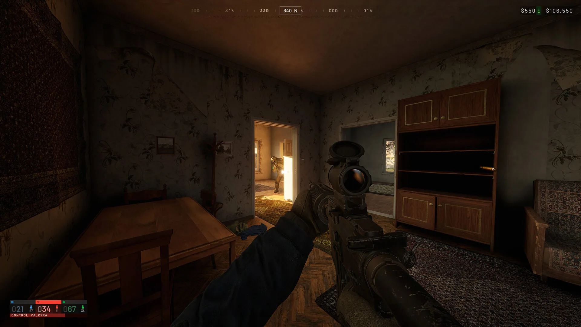
The official image set includes mountain and industrial environments, plus damaged structures and first-person views. A mountain context raises sightline and crossing questions. An industrial context raises cover, lanes and vehicle movement questions. A damaged building raises the possibility that a familiar route has changed. The image gives the player a visual prompt; the terrain decision still has to come from the live match.
A good observer calls the consequence of a surface or structure. A builder asks where a forward point can support the approach. A pilot asks whether the receiving area remains usable. A support player asks how a teammate can be recovered after the crossing. A tank or artillery tank asks whether the fire position can see the lane that matters. Terrain is useful when the role can act on its reading.
The gallery provides the official plates and Combined Arms provides the vehicle record. Keep both beside the terrain question so visual context does not become an invented map guide.
Destruction changes the route after the plan
Destruction is a confirmed battlefield system that can alter routes. That means the first map read has a short lifespan. A structure that provided cover can become an opening, a lane can become exposed, and a forward position can lose its value after the environment changes. The right response is not to repeat the original route more carefully; it is to identify the new approach and the role that can support it.
Construction creates the other half of the terrain conversation. A built FOB or forward point can restore coordination after a route has become difficult, giving players a place to recover, observe or prepare a transport run. The position should serve the current score and movement, because a permanent-looking object in an irrelevant lane does not help majority control.
Use the system filter in Operations to jump between Building / FOB and Destruction. The terrain page supplies the scale and route frame that lets those two records share one practical decision.
Transport, cash and recovery
Long terrain routes make logistics visible. Helicopter transport and Littlebird movement can shorten the distance between a squad and the zone, while cash can support a revive, equipment choice or objective action after the arrival. A player should ask whether the route needs speed, capacity, cover or recovery before spending or requesting a vehicle. The answer can change when the score moves toward 100.
Recovery is a terrain problem too. If a teammate falls near a useful position, support may preserve the squad’s presence. If the route is exposed, a builder or vehicle crew may need to create a safer next attempt. Local Voice Chat matters because the closest players have the information that determines whether a rescue is possible.
The public record does not provide a full traversal or damage model. Use the confirmed vehicle roles, cash links and destruction language, then learn the current environment through the live build.
A route review for the next match
After a Control Zone attempt, sketch the route in four words: arrival, sightline, cover, recovery. Which of the four failed? Arrival may need transport or a different cash spend. Sightline may need an observer or a new angle. Cover may need construction or a change after destruction. Recovery may need support, local voice or a less exposed approach. This review produces a next action without pretending to know the whole map.
Repeat the review after the environment changes. A route that worked in an intact industrial area may not work after a structure is damaged, and a mountain crossing may demand a different vehicle or support timing. The team’s goal remains majority control and the first-to-100 finish, so terrain is always evaluated against the score.
Return to Field Gallery for visual references, Combined Arms for confirmed vehicle roles, and Control Zone for the numbers that give the route urgency. Write down one changed route detail after the review, such as a lost sightline, a new cover gap, a longer transport leg or a recovery point that no longer works, and use that detail to choose the next role.
OFFICIAL RECORD TRAIL
Read the ground as a sequence of team decisions: arrive, see, hold, recover, then move again.